Cape Spear Path

Newfoundland and Labrador Tourism

02. Piccos Ridge Path

All Paths

Route:
Portugal Cove to Bauline
Current Path Status:
Closed, Caution

All Paths

Current Path Status:
Closed, Caution
Route:
Portugal Cove to Bauline
About This Path:

As of August 13th, 2025 Portugal Cove–St. Philip’s has closed ALL public trail access, by Fire Chief order – Effective immediately under Fire Department Operating By-Law Section 5.11.1 – Contact: chief@pcsp.ca – This applies to Piccos Ridge Path.

August 14th, 2025: Emergency Trail Safety Notice: This updated advisory reflects the serious and evolving situation on the Avalon Peninsula: multiple out-of-control wildfires are burning, with a regional state of emergency declared and a provincewide fire ban in effect. Please consider avoiding hiking altogether. If you must hike, limit yourself to a maximum of 10km total distance, take frequent rest periods, drink plenty of water, no fires, and never hike alone. The combination of extreme heat, fire danger, and compromised emergency response creates unacceptable risks for longer excursions. Be aware of fire safety notices and closures posted by individual towns along the Trail. Please carefully read the full notice here.


This path is recommended for experienced hikers. The path’s high point of Piccos Ridge, at an altitude of 250 m, provides expansive views, both of the coastline far to the north of Bauline and of the peninsula, inland, towards Pouch Cove. There is an optional exit point at Blast Hole Point Trail junction. Anticipate slippery conditions, especially with rain or frost. Long stretches of the trail are on high, open ground. Be prepared for exposed areas and associated wind chill. Exercise caution in all areas, but particularly descending/ascending the north slope of Black Cliff due to the steep grade.

Length
14.5km
Estimated time
7 Hours to 9 Hours
Difficulty

 STRENUOUS

Path Advisory: This is one of our most strenous paths. Some hikers will be challenged by steep areas at Black Cliff and Brock's Head. Hikers should exercise caution on these slopes. No path clearing or conditions updates take place during winter months. Map recommended. Trail-rated footwear required.
Access Points:
  • Portugal Cove - Do not park on North Point Road. Park behind the post office (1815 Portugal Cove Road), at the rear of the lot where there is signage. Return to Portugal Cove Road, turn left and follow the road for 250 m, then turn right onto Loop Drive. After 150 m, turn right onto Hardings Hill, cross the bridge over Main River, and hike for 300 m to North Point Road. Proceed 250 m to the end of North Point Road and the Piccos Ridge Path trailhead.
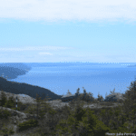
  • Bauline - Passing below the United Church, turn left onto Brook Path and park at the end of the road. Take the path to the right for 200 m which leads to a dirt road. Turn left, uphil, for 100 m, into a rock quarry. The Piccos Ridge trailhead sign is visible towards the bank, overlooking Conception Bay.
 
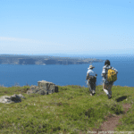
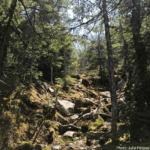
Preparing to Hike When choosing a hike, consider the length, the average time to complete and the difficulty rating. East Coast Trail paths do not loop - stated path distances are one way. Trail-rated hiking boots or shoes are a must on the East Coast Trail. Additionally, be sure to layer brightly colored, lightweight, quick-drying clothing for changing Newfoundland weather conditions. For a complete list of what to pack and more tips for hiking safely, click here.
Amenities
Optional Exit Or Access Point
Parking
Features
Berry Grounds
Brook Crossings
Coastline Views
Historic Site
Knoll
Pond
Ridge
Rock Outcrop
Rolling Elevation
Starrigans
Undeveloped Trail